🏜️ Desert Terrain Analysis

Desert Semantic
Segmentation

Every pixel classified. 10 terrain classes. Powered by DINOv2 vision transformer.

10 Classes
960×540 Resolution
DINOv2 Backbone
Background
Trees
Lush Bushes
Dry Grass
Dry Bushes
Ground Clutter
Logs
Rocks
Landscape
Sky

Training Dashboard

Model performance across training rounds with iterative improvements.

🎯
Mean IoU
Best
🔬
Mean Dice
Best
📐
Pixel Accuracy
Best
⏱️
Epochs Trained
Per Round

📈 Round-over-Round Improvement

Per-Class IoU — Round 1 vs Round 2

Loss Curves — Both Rounds

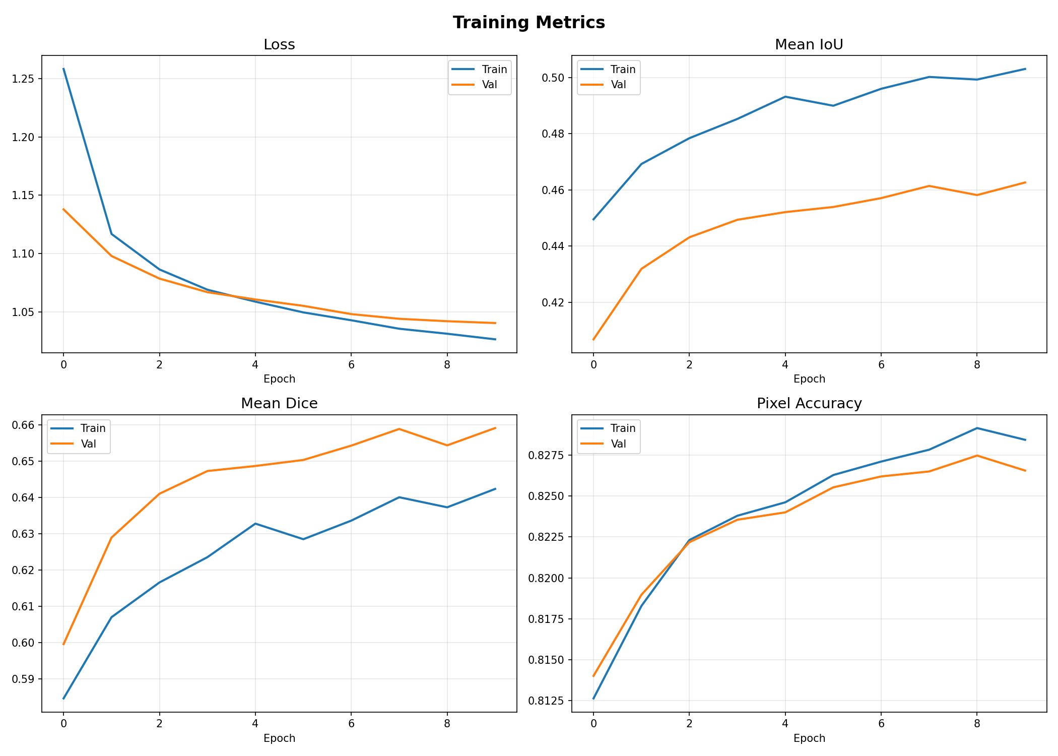
📊 Round 1 — Training Plots

Round 1 training curves

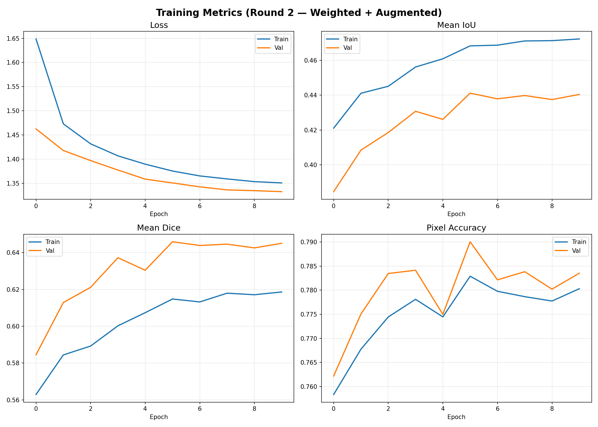
📊 Round 2 — Training Plots

Round 2 training curves

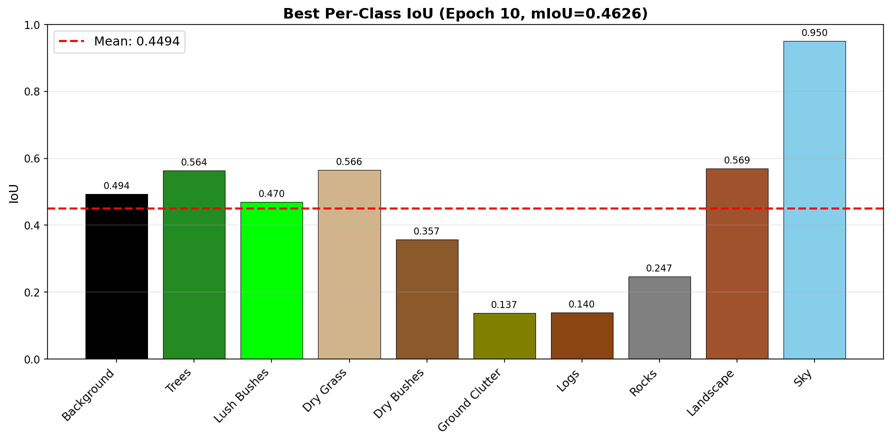
📊 Round 1 — Per-Class IoU

Round 1 per-class IoU

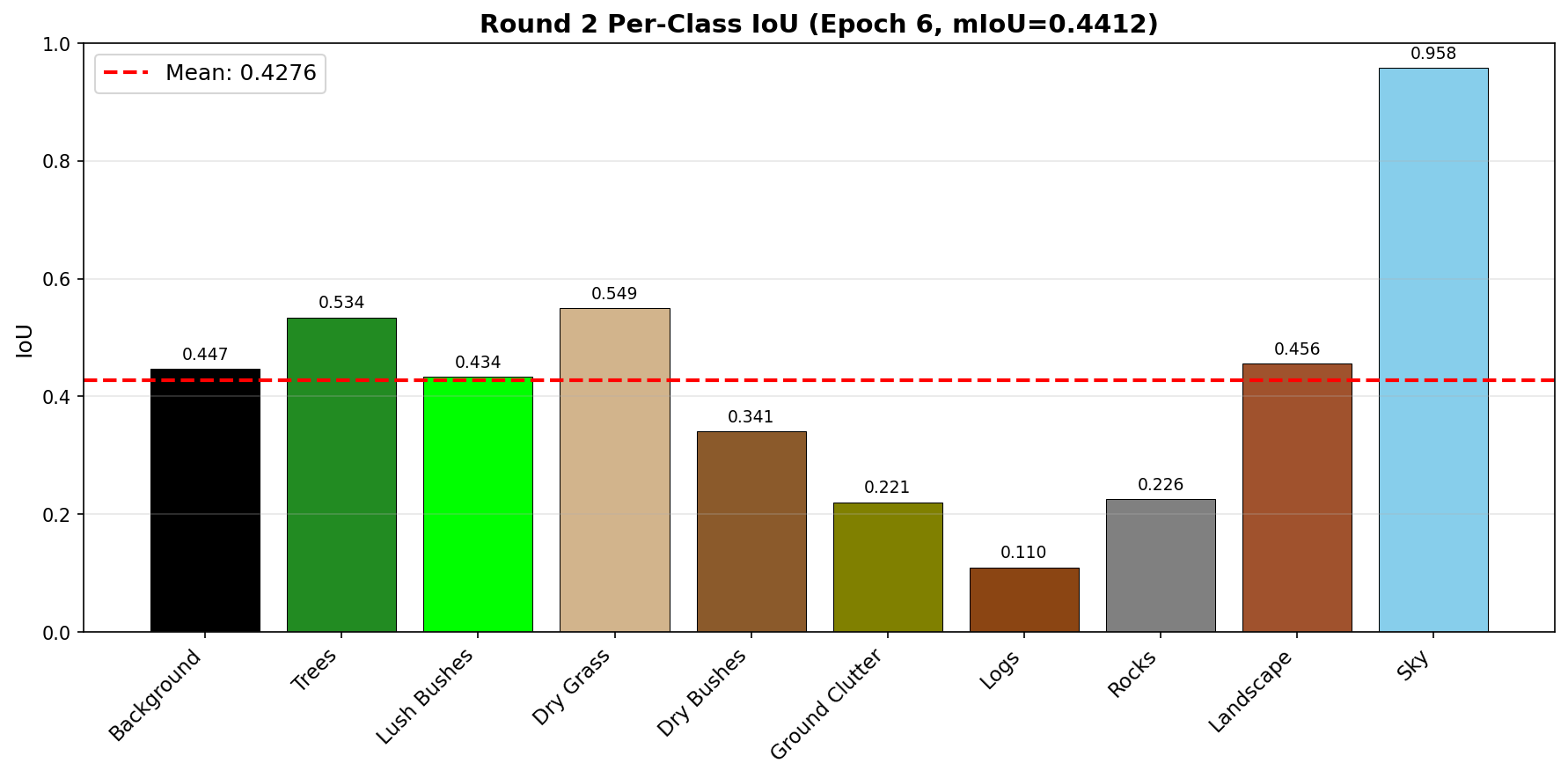
📊 Round 2 — Per-Class IoU

Round 2 per-class IoU

Class Performance Breakdown (Best Round)

Failure Case Analysis

Understanding where and why the model struggles — key to iterative improvement.

About the Project

Pixel-level understanding of desert terrain using deep learning.

🧠

The Approach

We use DINOv2 ViT-S/14 as a frozen feature extractor — a pretrained vision transformer from Meta that understands visual features without any domain-specific training. On top of it, we train a lightweight convolutional segmentation head that maps these features into 10 desert terrain classes.

📊

The Dataset

The Off-road Segmentation Dataset contains 960×540 desert terrain images with pixel-level annotations for 10 classes — from sky and trees to rocks and ground clutter.

Tech Stack

PyTorch DINOv2 Google Colab Chart.js HTML/CSS/JS